
SolidWorks
Experienced

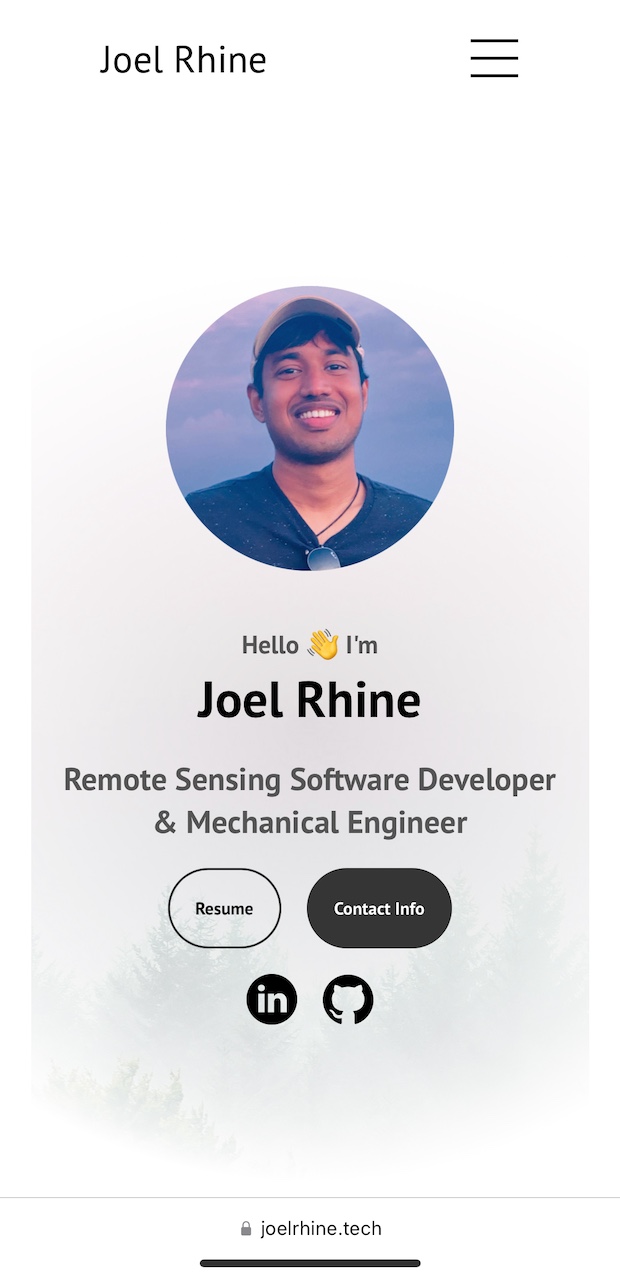
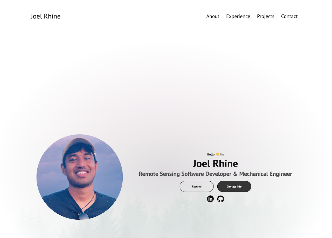
Hello 👋 I'm


Know More

6 YoE with fullstack software development with React, JS, Flask, Python, PostgreSQL, AWS and GCS

M.Sc. Mechanical Engineering & Aerospace
Engineering
B.Sc. Mechanical
Engineering

US Lawful Permanent Resident (LPR) / Green Card
Citizenship Application Eligibility in 2025 (US Citizen
Spouse)
Cross Functional
May 2024 - Present
Senior Software Engineer • Applications Development
The World Bank, Washington, DC
 📖 Guides and Docs
ReadTheDocs
ReST
Sphinx
Python
Clustering Analysis K-Means
ArcGIS Pro
KNN
Pandas
Geopandas
OSMNX
Research
Data Analysis
Technical Writing
Communication
Prioritization
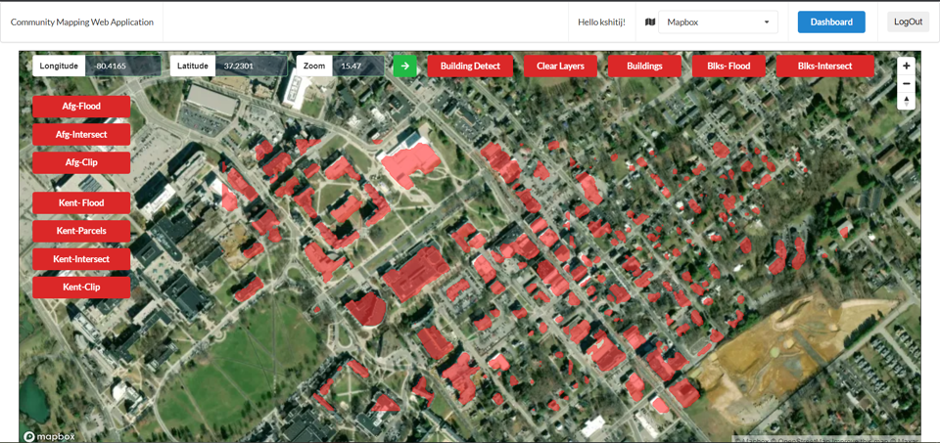
June 2019 - Apr 2024
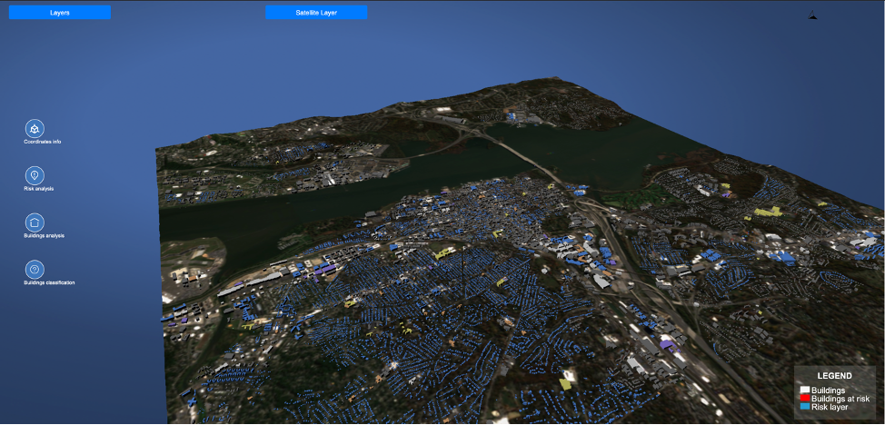
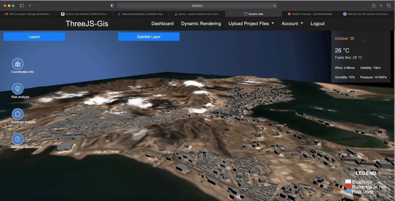
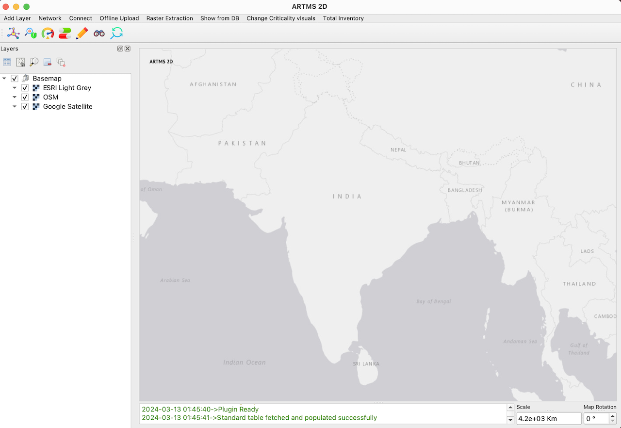
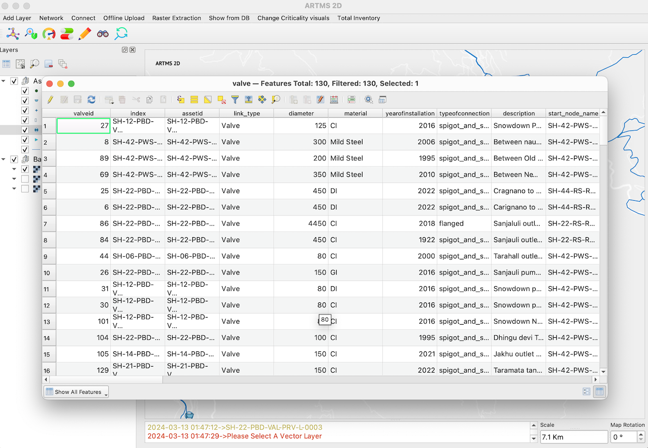
Senior Software Development Engineer • GIS and Remote Sensing Software Development
Development Monitors LLC, Arlington, VA
Python
PostgreSQL
React
AWS
ThreeJS
Machine Learning
KoBoToolbox API
WNTR
3D Modelling
Sentinel 2
OSMNX
Building Detection
Technical Proposal Writing
Leadership
Agile
Communication
Mentorship
Stakeholder Management
Risk Management
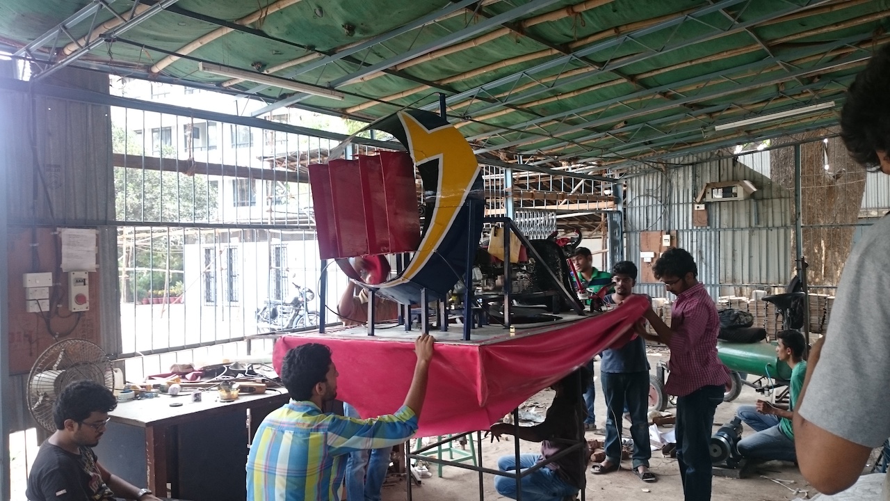
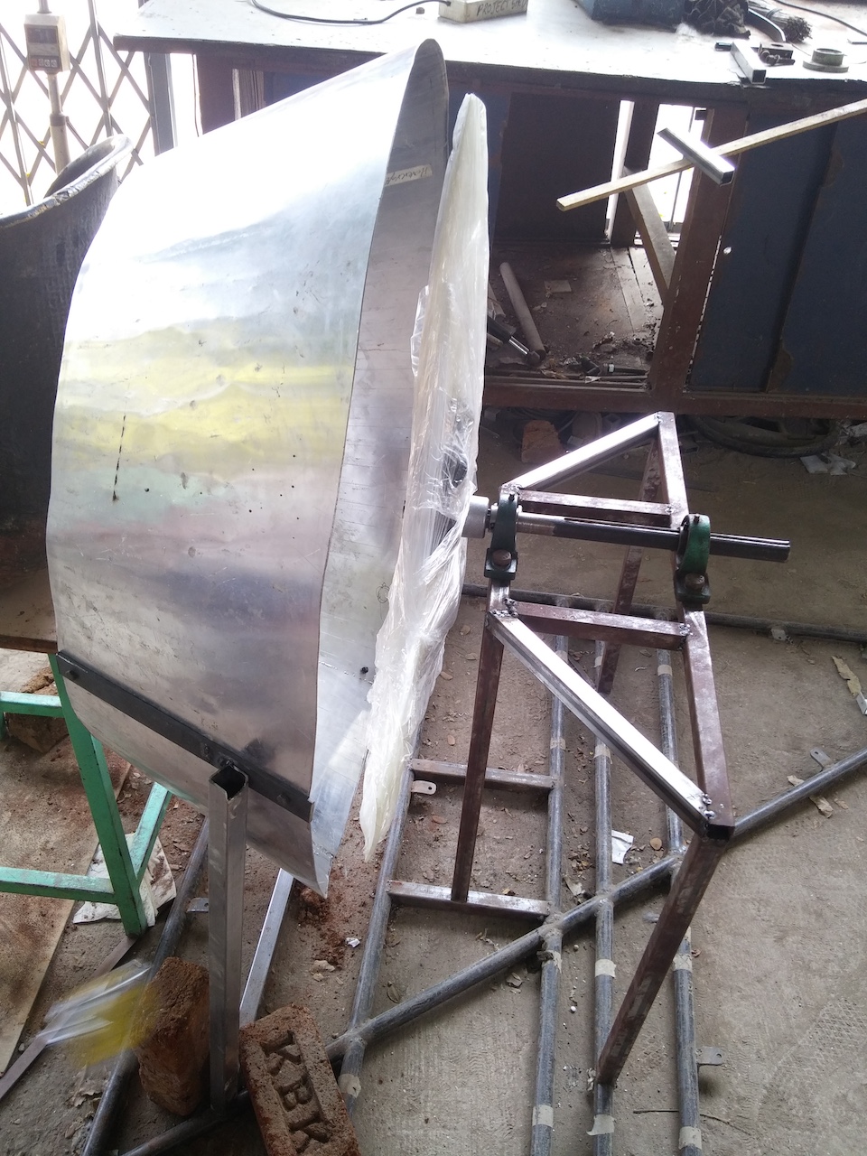
Jun 2019 - Apr 2021
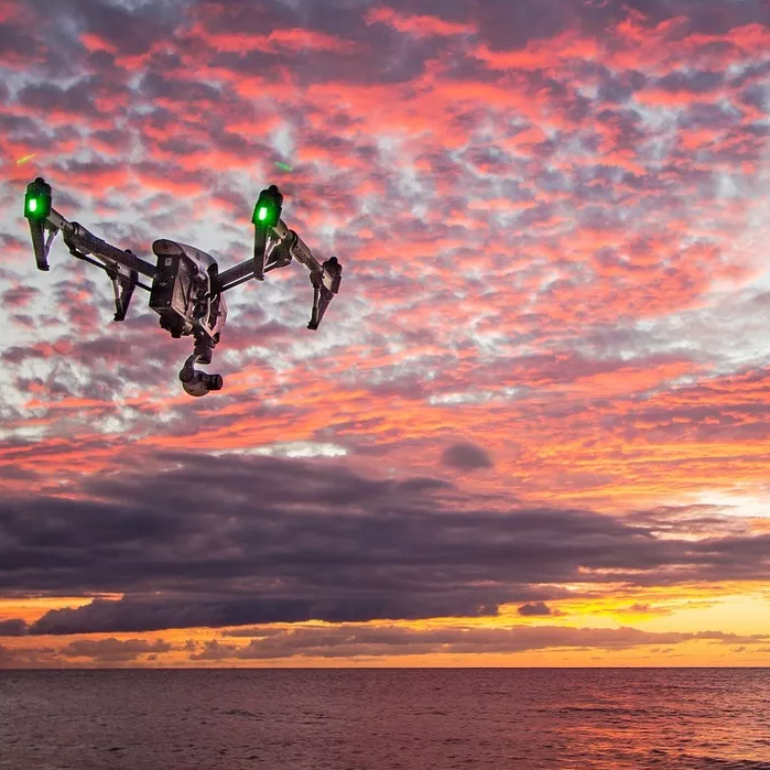
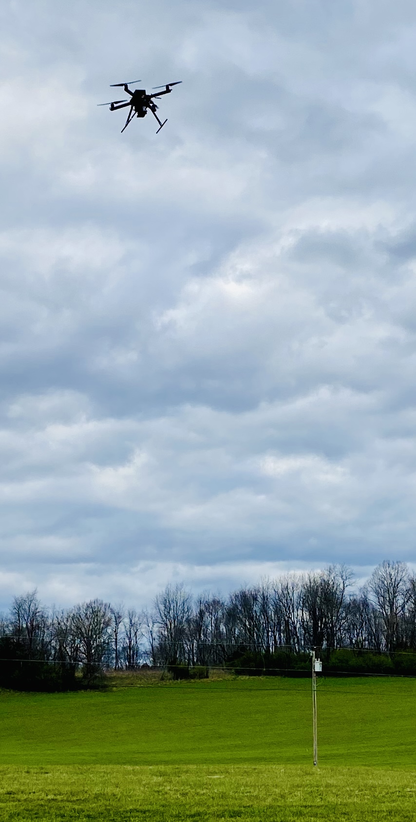
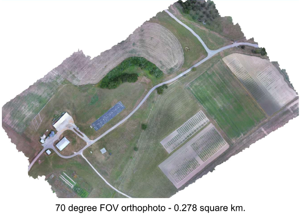
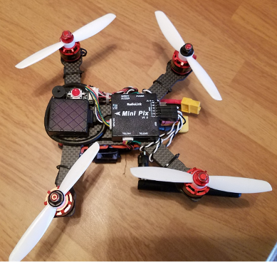
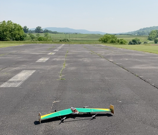
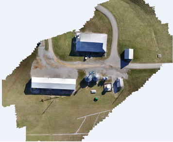
Mechanical Engineer • Remote Sensing UAV Development
Development Monitors LLC, Arlington, VA
CAD
Solidworks
UAV
3D Printing
Drone Pilot
Pixhawk
RTK/PPK
ODM
Communication
Organization
Technical Documentation
Jul 2019 - Apr 2023
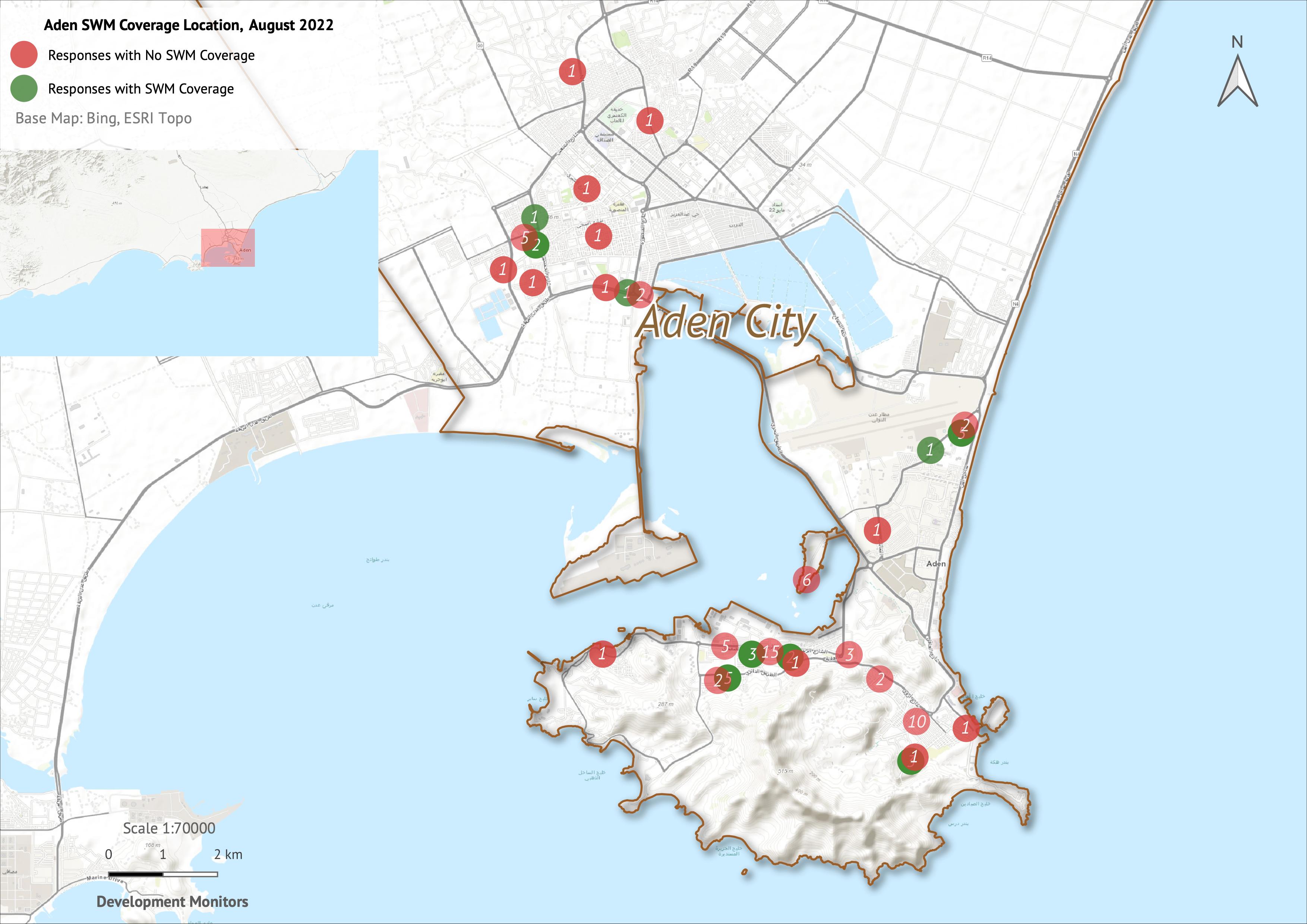
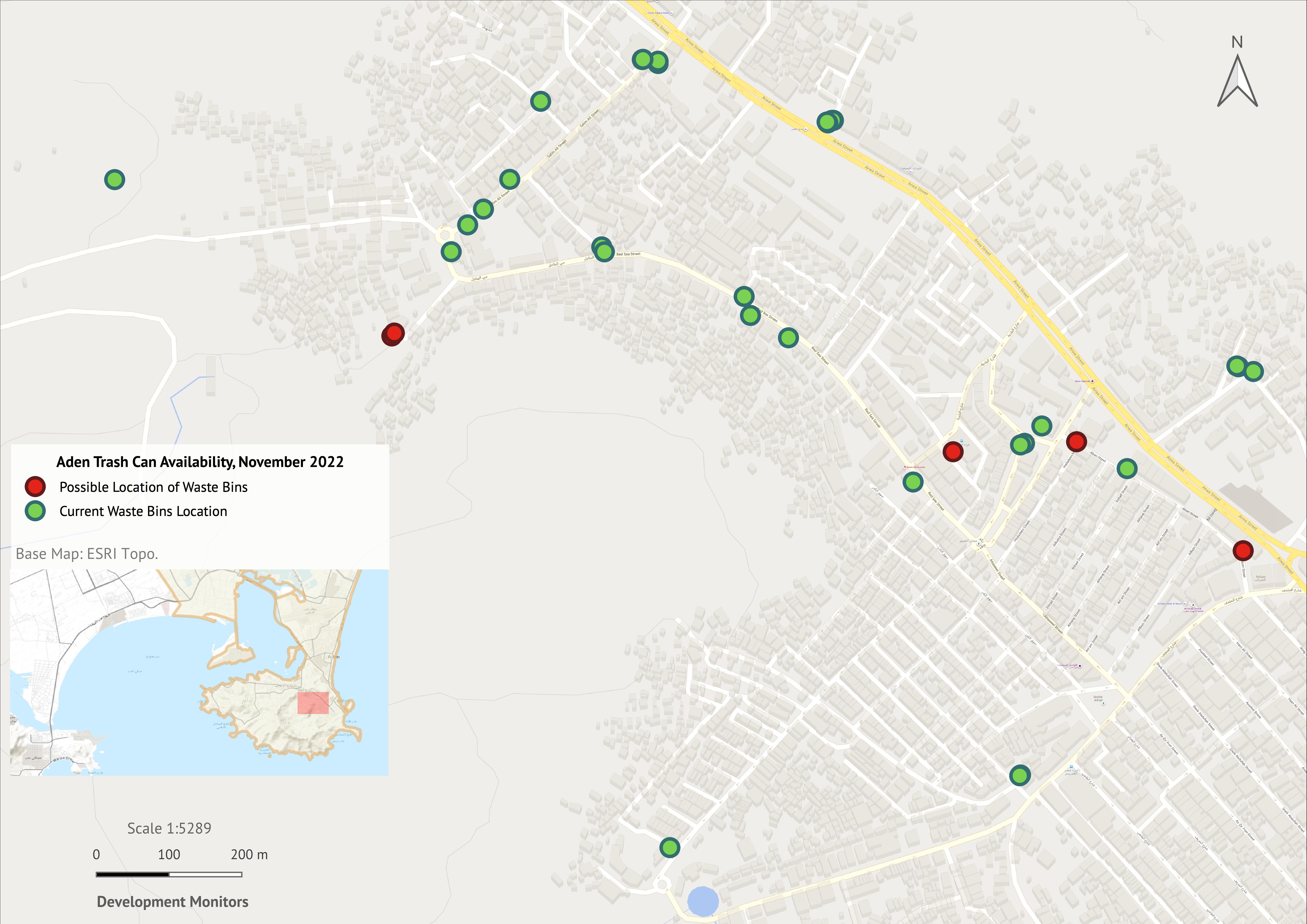
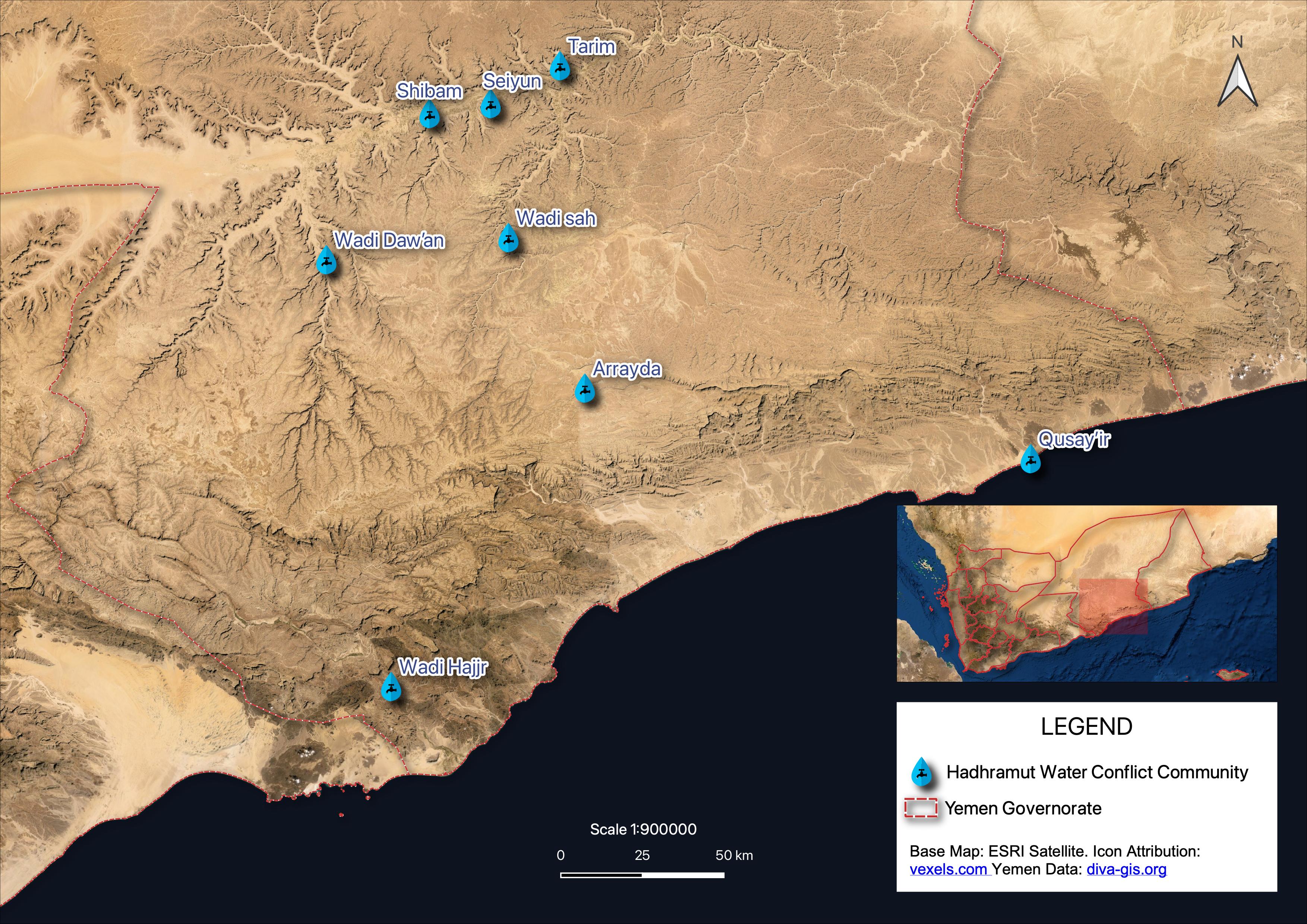
GIS and Remote Sensing Specialist • The World Bank and KfW Simultaneous Projects
Development Monitors LLC, Arlington, VA
GIS
Remote Sensing
Cartography
Data Visualization
QGIS
KoBoToolbox
Mapbox
Google Firebase
Natural Hazard Risk Analysis
Time Management
International Communication
Technical Proposal Writing
Explore Diverse
Experienced
Intermediate
Experienced
Experienced
Intermediate+
Experienced
Experienced
Experienced
Experienced
Experienced
Intermediate+
Intermediate+
Experienced
Experienced
Intermediate
Intermediate
Intermediate+
Experienced
Experienced
Intermediate+
Experienced
Experienced
Experienced
Experienced
Experienced
Experienced
Browse Recent

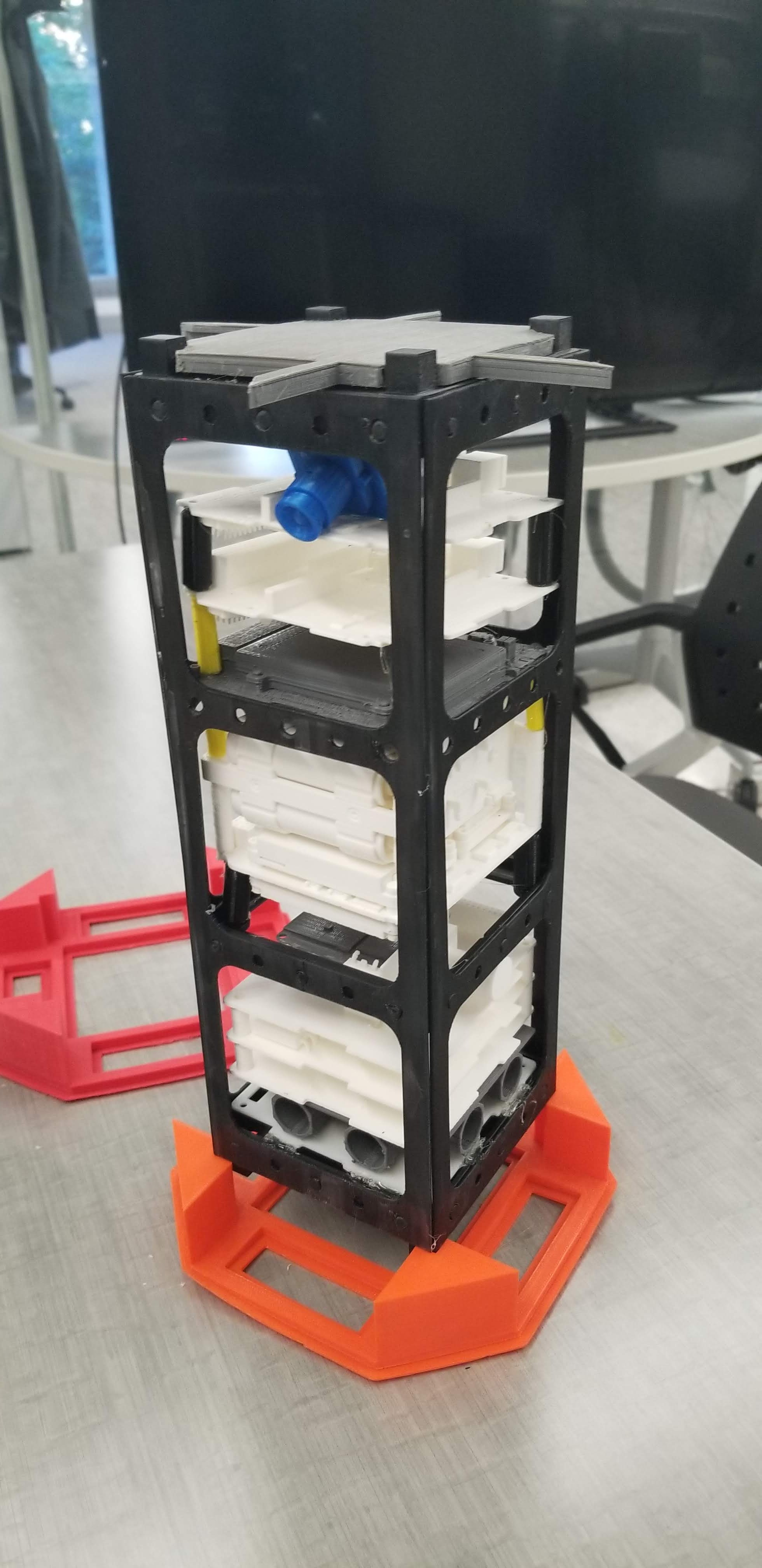
GW-CubeSat - A Cube-Satellite project selected by NASA's Cube Sat Launch Initiative (CSLI) program. Worked as a Structural and Thermals Engineer. Created detailed CAD models in Solidworks. Configured the on-board camera and prepared its User Documentation.
Hoverbolt 1.0 - A self-funded Pilot Driven Hovercraft project. Team Leader of a 10-member senior year Mechanical Engineering team. Developed multiple Hand-Drawn Sketches on paper before styling. Created deatiled 3D Models of all individual parts in SolidWorks as well as conducted structural analysis. Responsible for Engine Power Requirements and selection, thrust requirements and Propeller Selection and Overall Success of project. Conducted Vendor Negotiatiations and Procured Materials


